The United States Department of Agriculture has a fantastic Web Soil Survey (WSS) tool to help you discover what kind of soil you have, it’s physical and chemical characteristics, and which plants are considered native for your specific site.
The National Cooperative Soil Survey produces the web soil survey . The USDA Natural Resources Conservation Service (NRCS) operates the site and provides access to the largest natural resource information system in the world. The site is updated and maintained online as the single authoritative source of soil survey information.
Spend Some Time Exploring
You can explore online and, if you choose, get a report. Spend some time on the site. The information is fascinating and there are a lot of ways to look at the data and resources provided.
These step by step instructions will help you navigate the site. For purposes of illustration, we are using the address of the Travis County AgriLife Extension office. You will want to use your site address instead.
Step One: Go to the WSS Site
Go to Web Soil Survey Home page to get started. You’ll define your area of interest, view the soil map, and then explore the soil data on the soil designated for your site.
Step Two: Click the Start WSS Button
Click the big green button to enter into the database:
Step Three: Use the Area of Interest Tab to Define Your Area
The first tab is Area of Interest (AOI).
Enter in your address on the left side under the Quick Navigation Menu. For this example, we are using the Travis County AgriLife Extension office; 1600 Smith Road, Austin, TX 78721.
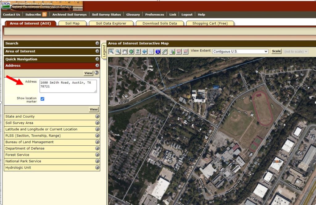
Now click View.
Use the buttons on the map to draw a rectangle around your site. This automatically creates the Area of Interest for you. It’s best to choose a larger, rather than smaller area to get the correct information. For the extension office, we choose to drag the rectangle over the entire window. Once you do that, you are ready to explore the data.
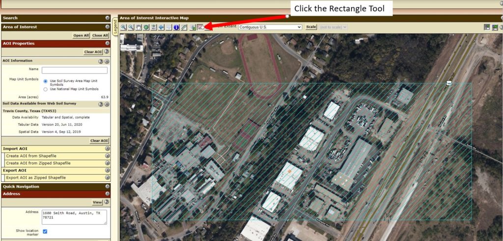
Step Four: Click the Soil Map Tab
Click the Soil Map tab to see the soil map for your site. Your site may have more than one type of soil. You can explore them all if you wish. The extension office sits directly across from a gravel pit on Hwy 183, which is why the GP appears. Click the map unit name link for a detailed description of the soils found at your site.
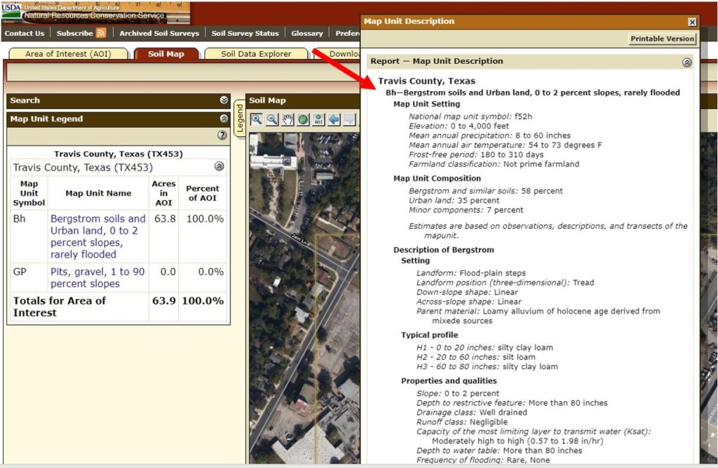
Step Five: Click the Soil Data Explorer Tab
The Soil Data Explorer area is where you will now spend most of your time. The Intro to Soils tab is a good list of resources if you are new to soil studies. The Suitabilities and Limitations for Use tab provides information on determining the suitability of the soils for a particular use. Expand the menu next to each topic to see more options. For this example we’ve expanded Soil Health and Vegetative Productivity.
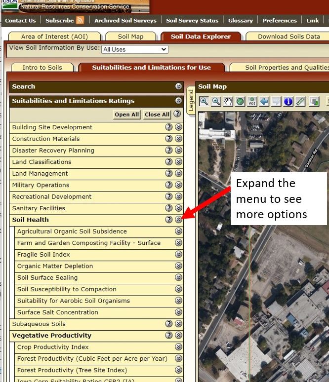
In some cases, you’ll need to enter a little more data to retrieve the information. In this example, in order to see Soil Health – Organic Matter ratings, you need to enter the depth of the soil profile. Choose a depth that represents the rootzone of the plants you have at the site. For example, for vegetables, use 3 to 6 inches. Shrubs, use 6 to 36 inches. Trees, use 6 to 48 inches. Try a few different values to see if it changes the data.

Step Six: Choose Ecological Sites
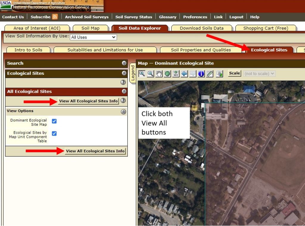
The Ecological Sites tab is especially useful if you want to see what plants used to grow natively for your area. This information can help you make better plant choices for your landscape. It’s also great information if you are trying to install a pocket prairie or woodland for your property.
Next, click on the Ecological Sites tab, and then click on both View All Ecological Sites Info buttons.
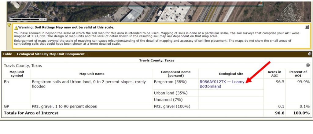
 Scroll the window all the way down to see which Ecological Sites are listed. Click on those links for more information. The extension office Map Unit Component is R086AY012TX – Loamy Bottomland.
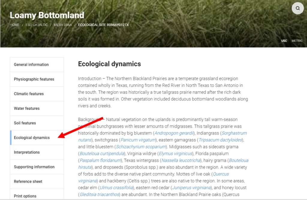
Go through the side navigation window to explore the information available. Ecological dynamics describes your site and will include native plants that used to (or maybe still) grow in your area. From this information we have learned that the extension office site is on the Northern Blackland Prairies grassland ecoregion, which historically was part of the tall-grass prairie.
Additional Resources for Soils and Composting</h3?
Using Coffee Grounds in the Garden
Great Gardens Begin with Great Soil
Texas A&M AgriLife Extension Soil, Water, and Forage Testing Laboratory
Calculate Amount of Soil, Mulch, or Compost to Purchase or Make
The Real Dirt on Austin Area Soils

